NOTA! Questo sito utilizza i cookie e tecnologie simili.
Se non si modificano le impostazioni del browser, l'utente accetta. Per saperne di piu'
Approvo
 Trappola per vespe
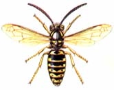
Esistono vari modi per catturare le vespe che certe estati infestano i nostri luoghi, sistemi che prevedono insetticidi, esche, a pagamento e non.
Vi proponiamo oggi un sistema fatto in casa che...
Read more
 Al Buighént e l'Burghenton
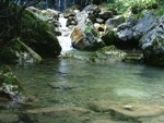
Burghént e Burghenton sono i nomi di due "pozze" (che voi potete anche chiamare "vasche naturali") create come tante altre in diversi punti del proprio letto dal torrente che scorre nella valle del...
Read more
Cenni storici
Pigra com'era
.AG_classic .ag_imageThumb {border-color:#808080}
.AG_classic .ag_imageThumb:hover {background-color:#fea804}
/* PAGINATION AND ALBUM STYLE DEFINITIONS */
#AG_01...
Read more
 Torta di sangue
Ingredienti (per 4-5 persone):
½ litro di sangue di maiale;
½ litro di latte;
una decina di noci tritate fini;
100 gr. di grana grattugiato;
1 cipolla piccola;
burro;
strutto;
sale e...
Read more
 Insalata di praa
Ingredienti (per 2 persone):
Insalata di praa (tarasaco o dente di leone) bella tenera raccolta prima che faccia il caratteristico fiore giallo;
2 uova;
mezzo bicchiere di aceto;
1 hg di...
Read more
Insalata di praa
Ingredienti (per 2 persone):
Insalata di praa (tarasaco o dente di leone) bella tenera raccolta prima che faccia il caratteristico fiore giallo;
2 uova;
mezzo bicchiere di aceto;
1 hg di...
Read more
 AL LUTT DAL CAMPANIN
Pasa fughent sul campanin 'na sbira.La và, la và`fin caa ga paar a see...e poo la frena e poo bel bell la gira,la vola pusee fort, la turna indree.La riva in primavera da 'na...
Read more
AL LUTT DAL CAMPANIN
AL LUTT DAL CAMPANIN
Pasa fughent sul campanin 'na sbira.La và, la và`fin caa ga paar a see...e poo la frena e poo bel bell la gira,la vola pusee fort, la turna indree.La riva in primavera da 'na...
Read more
Dizionario
Dizionario Pigrese --> Italiano
In questa sezione si vuole ricordare i termini noti o meno noti utilizzati a Pigra. Il lavoro è già stato pregevolmente affrontato da Deo Ceschina nel suo bellissimo...
Read more
 Giochi di Piazza
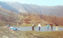
Fin dall'antichità le piazze erano luogo d'incontro e punto centrale della vita pubblica. In esse si riuniva il governo della città, si tenevano i processi e si esercitavano le pene, si svolgevano i...
Read more
 Torta di Zucca
Ingredienti (per 4 persone);
500 gr. di zucca;
150 gr. di farina gialla;
sale;
spezie;
un poco di aromatic Knorr;
mezzo bicchiere d'olio;
una manciata di menta possibilmente secca.
Cuocere...
Read more
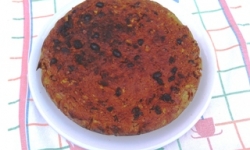 Torta Santa Margherita
Ingredienti:
4 o 5 pani vecchi;
3 uova (albume + tuorlo);
60 grammi di burro;
circa tre quarti di scatola di cacao amaro;
un sacchetto di uva sultanina;
un pizzico di spezie composte;
8...
Read more
Dizionario A
Ábat
sm.
Veste bianca con mantellina rossa indossata dagli uomini che durante le processioni portavano la statura del santo, o il crocifisso, o le grandi lanterne.
aé
avv.
Può essere un...
Read more
 Fighiscioo
Ingredienti (per 3 persone):
1 uovo;
1 bicchiere di latte;
2 bicchieri di acqua frizzante;
200 gr. di farina bianca;
un pizzico di sale;
olio di semi per la cottura;
a piacere si può...
Read more
 Qui si fa l’Italia o si muore
“Qui si fa l’Italia o si muore”
Giuseppe Garibaldi
Il 17 marzo 2011 l’Italia festeggia il suo compleanno: 150 anni di unità, rendendo omaggio a un grande condottiero che realizzò un sogno. Era il...
Read more
 Gnoc dal cugiaa
Ingredienti (per 3 persone):
½ litro di latte;
2 michette di pane raffermo;
1 uovo;
200 o 300 gr. di farina bianca;
qualche patata;
burro;
pancetta;
salvia;
aglio.
Mettere le michette...
Read more
 Al bèes: Il Baseball di Pigra
Al bèes
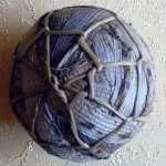
Il bèes era un gioco praticato indifferentemente da squadre di ragazzi, da squadre di ragazze e da squadre miste di ragazzi e di ragazze. In ogni caso le squadre contrapposte si formavano...
Read more
 CHIESA PATRONALE S.MARGHERITA
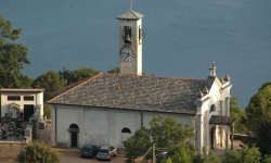
(ubicazione e cenni artistici)
La Parrocchiale di S.Margherita sorge a 200 mt. a sud del Paese, vicino al Cimitero, in posizione panoramica.
Dalle ricerche fatte...
Read more
CHIESA PATRONALE S.MARGHERITA
CHIESA PATRONALE S.MARGHERITA
(ubicazione e cenni artistici)
La Parrocchiale di S.Margherita sorge a 200 mt. a sud del Paese, vicino al Cimitero, in posizione panoramica.
Dalle ricerche fatte...
Read more
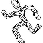 Maghi e lìbar (Maghi e liberi)
Tra i giochi che contrapponevano due squadre era uno dei preferiti, forse perché consentiva di sfogare in lunghe corse, come inseguito o come inseguitore, l’esuberanza dell’età.
Aveva regole molto...
Read more
Storia d'archivio
Archivi del Comune di Pigra
Il comune di Pigra risulta far parte della pieve d'Intelvi dal "Liber consulum civitatis Novocomi" dove sono riportati i giuramenti prestati dai consoli del comune dal...
Read more
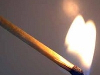 Giochi di Pigra: Al fòcu
Al fòcu
Il fòcu era il più spettacolare dei vecchi giochi che contrapponevano due squadre. Specialmente all’inizio, quando entrambe erano ancora al completo o quasi, proponeva fasi di grande...
Read more
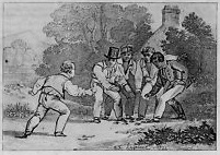 Giochi antichi: Il boeugi
Il boeugi (Le buche)
Anche al boeugi si giocava generalmente in piazza, sebbene fosse adatto qualsiasi luogo che avesse il fondo in terra battuta e fosse abbastanza spazioso. Il fondo in terra...
Read more
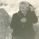 La Vipera con la cresta
Nonna Zaneta, rannicchiata col suo esile corpo su un piccolo sgabello accanto al camino, giurava di averla vista sopra il pizzo curnà, ove ora sorge la stazione della funivia. Eretta e sibilante,...
Read more
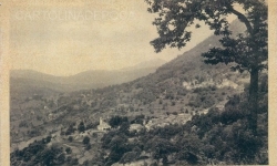 Poesia di Mauro Grimoldi: Lura
Lura...
Quando giù fa troppo caldo,
ed aumenta la calura,
una cosa tu puoi fare:
corri al fresco in quel di Lura.
E' un simpatico paesino
fra Blessagno e San Fedele,
io da lui sono...
Read more
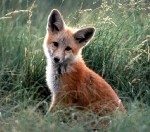 La volpe e i suoi volpacchiotti.
Mi ero incamminata, alle cinque del pomeriggio, verso Piazza Nava, per godermi i soliti "particolari ": la lucertola al sole, i garofanini rossi fra l'erba, i...
Read more
La volpe e i suoi volpacchiotti.
La volpe e i suoi volpacchiotti.
Mi ero incamminata, alle cinque del pomeriggio, verso Piazza Nava, per godermi i soliti "particolari ": la lucertola al sole, i garofanini rossi fra l'erba, i...
Read more
 Furmentada
Ingredienti (per 6 Persone);
3 o 4 patate un po' grosse;
250 gr. di frumento decorticato;
1 litro di latte;
1 cipolla grossa;
prezzemolo;
un rametto di salvia;
1 scatola di fagioli...
Read more
PICCOLA GUIDA ALLA SCOPERTA DI PIGRA STORICO VILLAGGIO ALPINO IMMERSO NELLA NATURA IN SOSPESO TRA LAGO E CIELO
SALI VERSO IL CIELO,
FERMATI A PIGRA,
SCOPRI QUANTO E' BELLO VEDERE IL LAGO, LE MONTAGNE E LE STELLE LONTANO
PICCOLA GUIDA ALLA SCOPERTA DI PIGRA STORICO VILLAGGIO ALPINO IMMERSO NELLA NATURA...
Read more
Si scrive su Pigra
Si scrive su Pigra
COMO IL MINISTRO FU SEGRETARIO COMUNALE NEL PAESINO DELLA VAL D' INTELVI
Di Pietro torna a Pigra. E ci trova Borrelli
Si chiama Gennaro, è il suo successore ed è al...
Read more
Meteo
I Gat da Pigra
La Società Operaia di Pigra
Notizie Eliseo
Aggiornata Sezione
Storia e Tradizioni
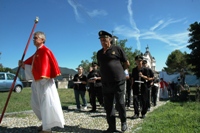
LUGLIO - LA PROCESSIONE DI SANTA MARGHERITA
Ass. non ti scordar di me
"Associazione non ti scordar di me"

Media
Nella pagina dei Media puoi trovare
PIGRA DEGLI ANNI '80

- Mostra del Fungo
- Festa alla Società Operaia
- Festa Alpina
scene di vita, interviste e altro.
Link Utili
| Comunità Montana LarioIntelvese  |
|
| Comune di San Fedele  |
|
In Bike con la funivia
E' POSSIBILE

Con un supplemento di soli 3.90 € è possibile trasportare la bike in funivia e lanciarti verso la zona dei rifugi con il più bel panorama delle prealpi.


